
Introduction
On this part of the website the fieldwork by the Groningen Institute of Archaeology (GIA) is briefly discussed. The GIA has been active at Crustumerium since 2006, collaborating with several international partners within the framework of the International Crustumerium Project (ICP). The ICP was set up by Francesco di Gennaro, former inspector of the then fourth municipium of Rome. The fruitful collaboration between the University of Groningen and the Soprintendenza of Rome still continues.
Within the framework of this collaboration, excavations were carried out jointly each summer in the Monte Del Bufalo cemetery. At the same time, intermittent field campaigns were organised, dedicated to landscape archaeological research comprising urban and rural survey, geophysics, coring, and test-pitting.
To date, no less than 19 field campaigns and four artefact study campaigns have been carried out providing new and important data on the site’s topography and conservation status, its urban and rural surface record, the defensive works, its cemeteries, and areas of ancient tuff quarrying. All campaigns included artefact studies as well as conservation and restoration work.
▲ This clip gives an impression of the excavation at Crustumerium. Second-year students receive their training in Mediterranean Archaeology and work together with more experienced students, staff of the GIA, and Italian excavators.
Excavations
From the summer of 2006 onwards, the Groningen Institute of Archaeology has been intensively involved in the investigations of the Monte Del Bufalo funerary area, working side by side with the Soprintendenza of Rome. The investigations were carried out by students of our own institute and from other (foreign) universities and were supervised by Peter Attema, Albert Nijboer, and Sarah Willemsen. The tombs investigated by the GIA are very varied in terms of architecture, date, and funerary wealth.
The first campaigns were carried out in the southern part of Monte Del Bufalo, where the Soprintendenza had already investigated a large number of tombs. In this area, we have excavated a number of fairly wealthy fossa tombs dating to the first half of the seventh century, and chamber tombs dating to the beginning of the sixth century BC.
Between 2008 and 2018, attention shifted to the northern part of Monte Del Bufalo, located next to the defensive works on the southeastern side of the settlement. Some of the tombs in this area had suffered severely from erosion as a result of ploughing, others have been fairly well preserved. All in all, the excavations have provided us with a fairly good understanding of the funerary customs practiced at Crustumerium and of the way they changed over time.
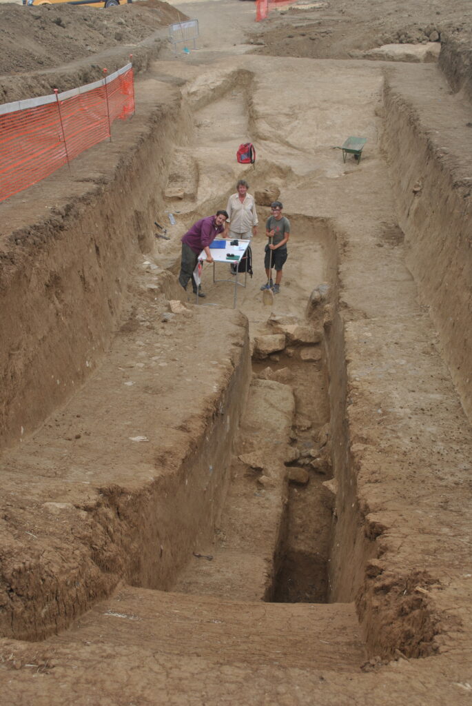
From 2013 onward, additional focus was placed on the settlement area, first by means of test pit investigation and later by large-scale excavations. Over the course of five summers (2014-2018) we targeted an immense artificial hill (known as Quilici site O) precisely on the border between the settlement and the burial ground of Monte Del Bufalo.
◄ The excavation of the artificial hill at Quilici site O in 2017. The hill measures ca. 4000 m², has a height of 5 to 6 m, and is composed of a mix of soil, mudbricks, tuff chunks, and building debris. Long sections help to study its complicated stratigraphy.
Surveys
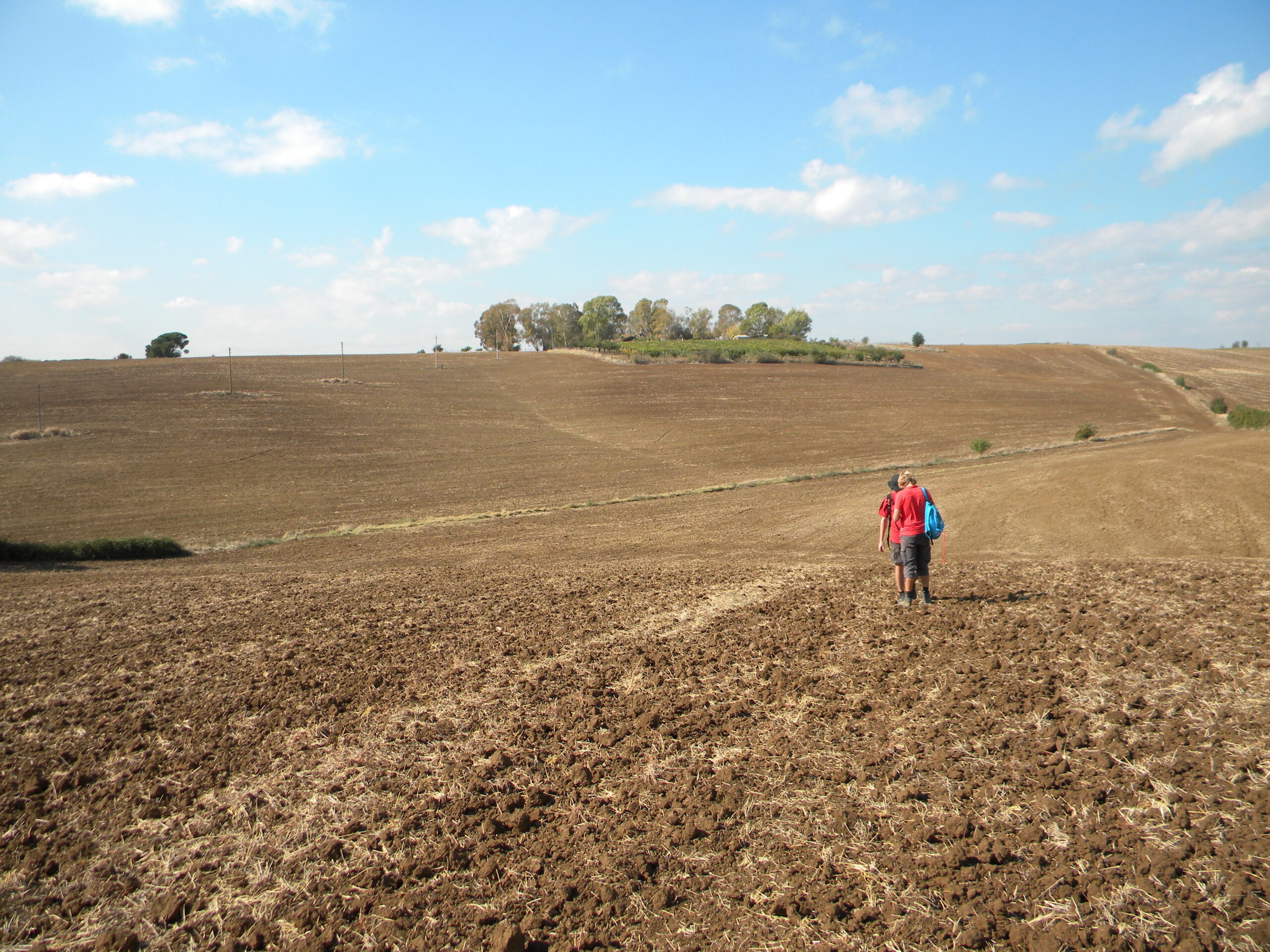
The location of ancient Crustumerium was established with certainty only in the 1970s, through fieldwork of Lorenzo Quilici and Stefania Quilici Gigli (published in 1980). Their topographical studies used the non-invasive method of ‘field-walking’ to map directly visible archaeology; i.e. monuments, landscape modifications, and surface scatters of ceramics.
This way, they were able to cover huge areas in a short time and with limited resources to create invaluable archaeological maps. Their work strongly illustrates the enormous value and benefits of archaeological survey investigations. An even more detailed and systematic study of northern Rome and Crustumerium was performed within the ‘Suburbium’ project of the La Sapienza University of Rome some 20 years later.
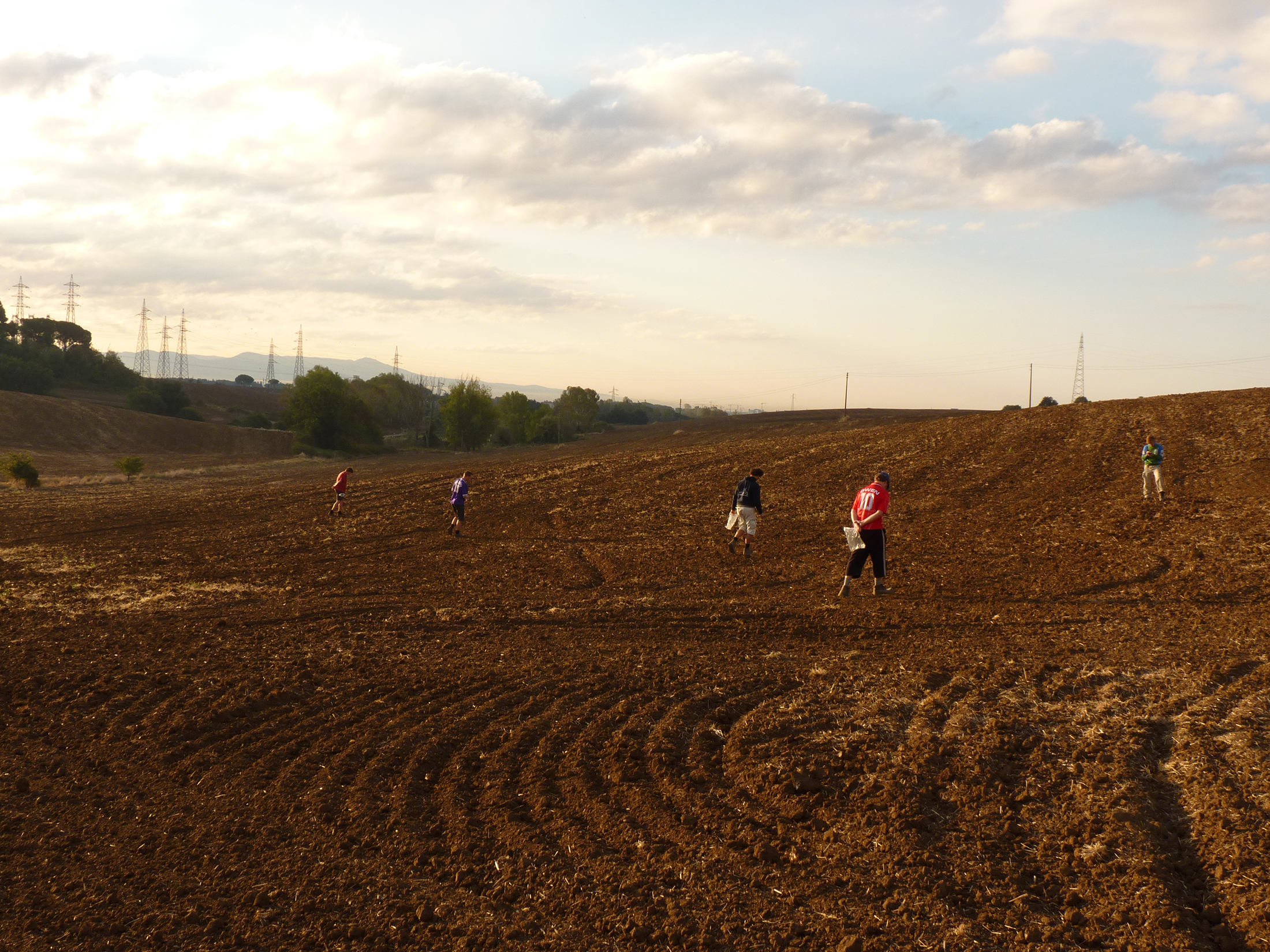
A new survey of part of the settlement was performed by the GIA in 2011. The survey aimed at acquiring higher resolution information on the spatial distribution of surface ceramics, both in terms of the density and chronology of finds, to improve our understanding of changes in the surface record in relation to actual subsurface remains and processes of erosion.
In addition, a so-called rural survey in the ancient territory of Crustumerium was carried out, primarily to clear up some issues observed in the older data, especially in regard to find chronology, find densities, and internal find distribution. Several areas within a 2.5 km radius to the south and east of Crustumerium were surveyed intensively under conditions of very good surface visibility.
Over 42,000 sherds were studied to provide data for an interpretation of the local settlement history and to analyse the relationship between the data of our own ‘sites’ and the records of previous research.


▲ A block-lift from tomb MDB 59 during micro-excavation in the lab. Before treatment, an x-ray photograph was taken to reveal the metal parts of the ornaments; other materials such as bone/ivory and glass are visible but need a trained eye and a digital image that can be reworked.
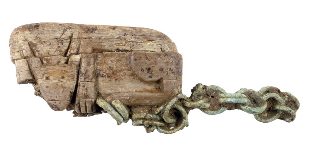
▲ A bone amulet probably representing a couchant wolf from Crustumerium tomb MDB 59, after conservation.
Conservation and Restoration
During the excavation campaigns, a field laboratory for conservation is set up on the site. The finds from the necropolis and settlement are being cleaned, conserved, and restored there.
Before recovering objects or human skeletal remains from the tombs at Crustumerium, consolidation measures are taken in the field. At times, objects and skeletal remains have to be lifted together with the soil. These so-called block-lifts are then transported to the laboratory where specialists can work under optimal conditions to carry out their high precision investigations of the objects and human skeletal remains.
Since most of the objects have been broken or have deteriorated due to post-depositional alterations, conservation and reconstruction are essential for a full study of the finds. Some of the objects have been restored in a field laboratory during the campaigns at Crustumerium. The majority of the artefacts could, however, be conserved in the Laboratory for Conservation and Material studies (LCM) at Groningen thanks to the yearly export permits granted by the Soprintendenza of Rome.
Conditions in the field are occasionally unfavourable for conserving or lifting fragile and intricate artefacts individually. As an example we present the laboratory excavation and conservation of tomb MDB 59 that was excavated at Crustumerium in the summer of 2012 (see images to the left).
During excavation, it became apparent that the deceased was buried with a number of brittle ornaments of exceptional quality, entangled in such a way that laboratory excavation was required. To this end, part of the skull and thorax of the body were lifted as a block. The block-lift was subsequently excavated in the lab. Exploratory X-ray imaging confirmed the presence of a number of bronze fibulae, and ornaments in amber and ivory, as well as numerous small glass beads probably once part of a necklace. In addition to these, the excavation in the laboratory revealed an amulet.